
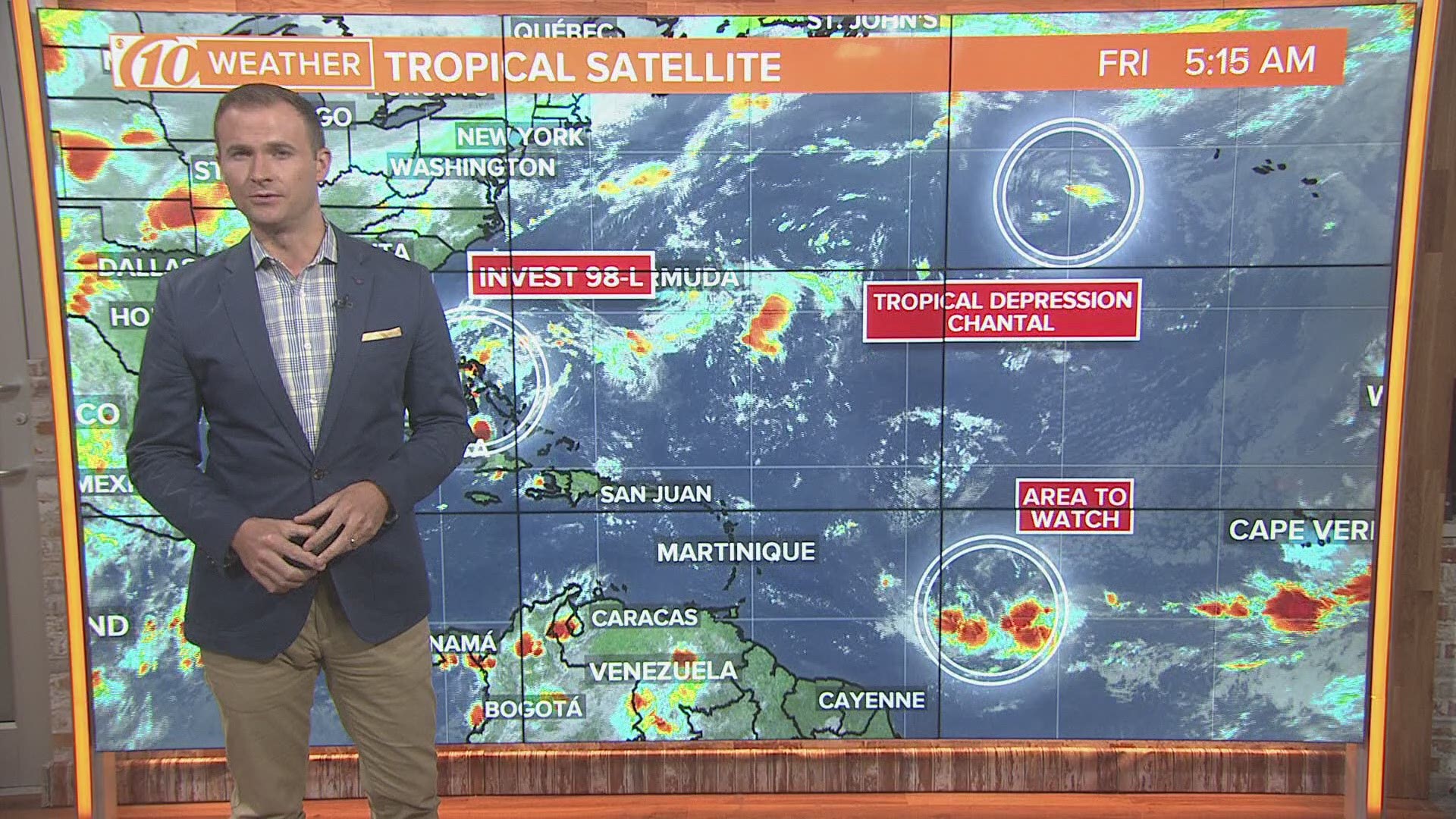
ST. PETERSBURG, Fla. — Earlier this week Tropical Storm Chantal developed in the northern Atlantic and now another system is showing signs of development much closer to home.
A weak area of low pressure has developed between the southeastern coast of Florida and Andros Island in the northwestern Bahamas. This system is producing a large area of disorganized cloudiness and showers.
The area of low pressure is forecast to move near or over Florida on Friday into Saturday. The interaction with land will likely limit any development or strengthening.
Regardless of development, locally heavy rains will still be possible across southern and central Florida during the next few days. Rainfall totals may reach 1-2 inches.
Tampa will only have minimal impacts from this system with only a 40% chance of scattered afternoon storms on Saturday and then a 60% chance of scattered afternoon storms on Sunday.
By Sunday the center of low pressure is forecast to move out over the Atlantic Ocean off the Southeast coast and continue to track to the northeast. Once the system begins to move away from Florida conditions look to become more favorable for development and the system could strengthen to a tropical depression by Sunday or early next week.
Right now the National Hurricane Center gives the system a 90% chance of development over the next five days. There is a 70% chance that the system becomes a tropical depression before Sunday.
As the system parallels the southeast coast of the U.S. some strengthening is possible before it meets up with a cold front that will be dropping southeast out of the Mid-Atlantic states. This surface front and associated upper-level trough will continue to curve the storm away from land and out into the Atlantic.
Continue to check back with 10News and our team of meteorologists through the weekend for continued updates as this system takes shape over the next several days.
What other people are reading right now:
- 27 injured in light rail collision in Sacramento
- Port Richey man accused of forcing boy to sit on toilet for hours
- Woman brings meth to her court appearance for drug charges, deputies say
- Video shows woman shoving ailing dog into car trunk
- Florida serial killer who targeted gay men set to die tonight, here's the last meal he ordered
►Make it easy to keep up-to-date with more stories like this. Download the 10News app now.
Have a news tip? Email desk@wtsp.com, or visit our Facebook page or Twitter feed.